Hello to all of you people of mastodon! 🤗
This is my #introduction
Here I will share stuff and links that I would like more people to know, I will also try to write some reflexions and though on my projects. I live in Normandy, France. My current topics of interests are various: #programming #bike #osm #climatechange #selfhosting #freeSoftware #linux #maps #openstreetmap #wikidata #rust #python
I speak french 🇫🇷 and english 🇬🇧 .
maps
If you're into map making geekery, this is a great Ted Talk about the biggest mistakes cartographers have made about the Earth's geography.
https://www.ted.com/talks/kayla_wolf_the_biggest_mistakes_in_mapmaking_history?language=en
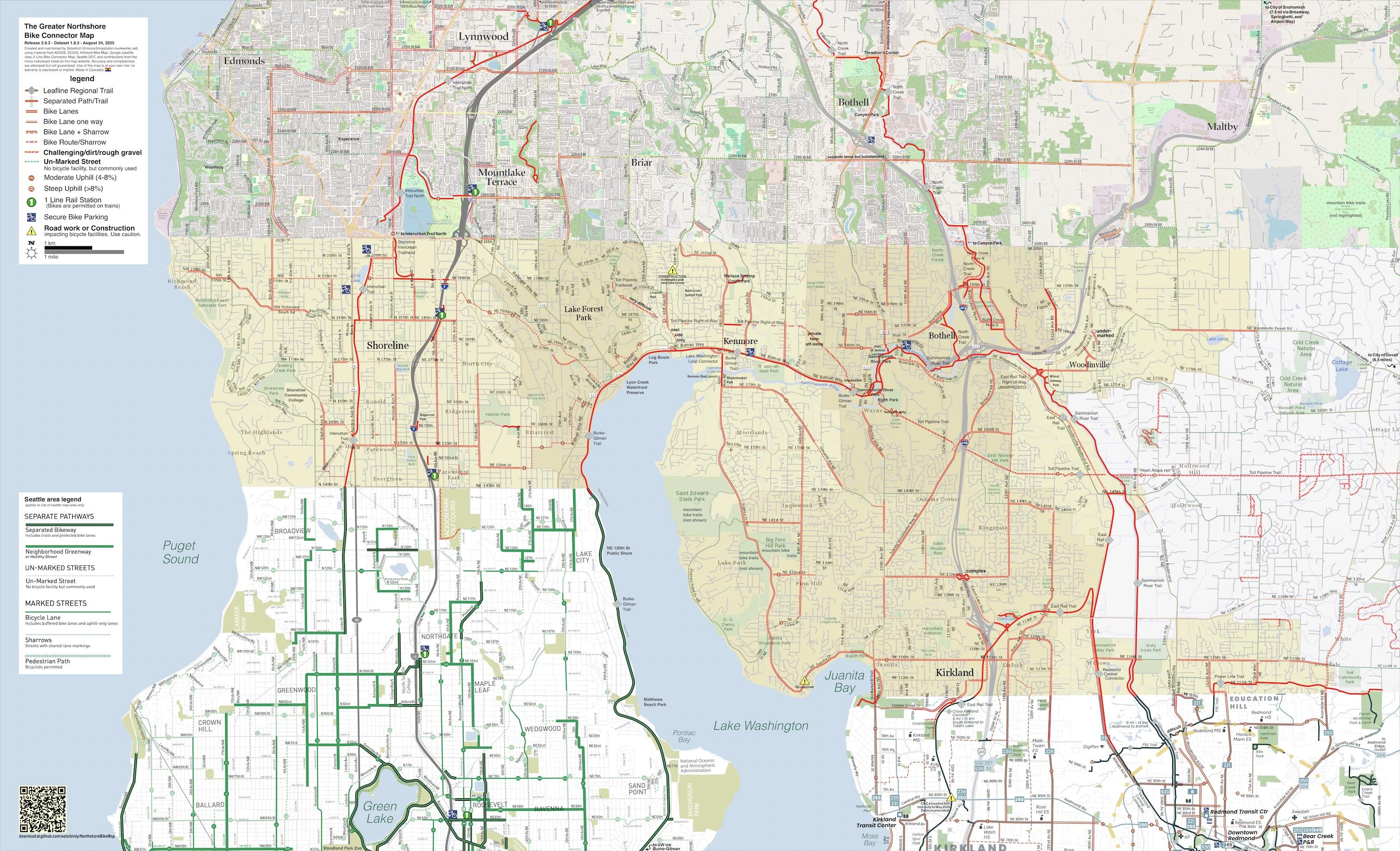
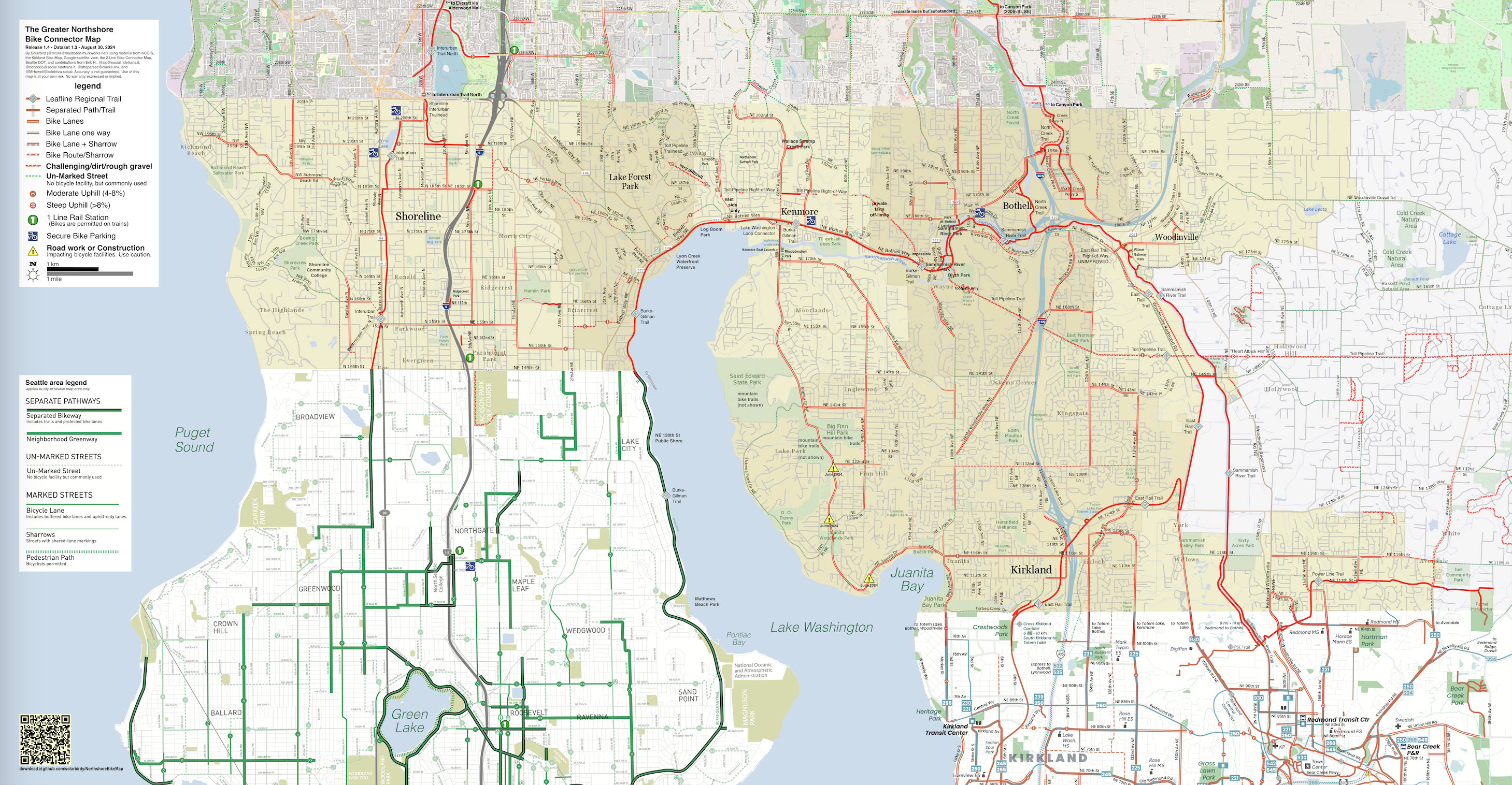
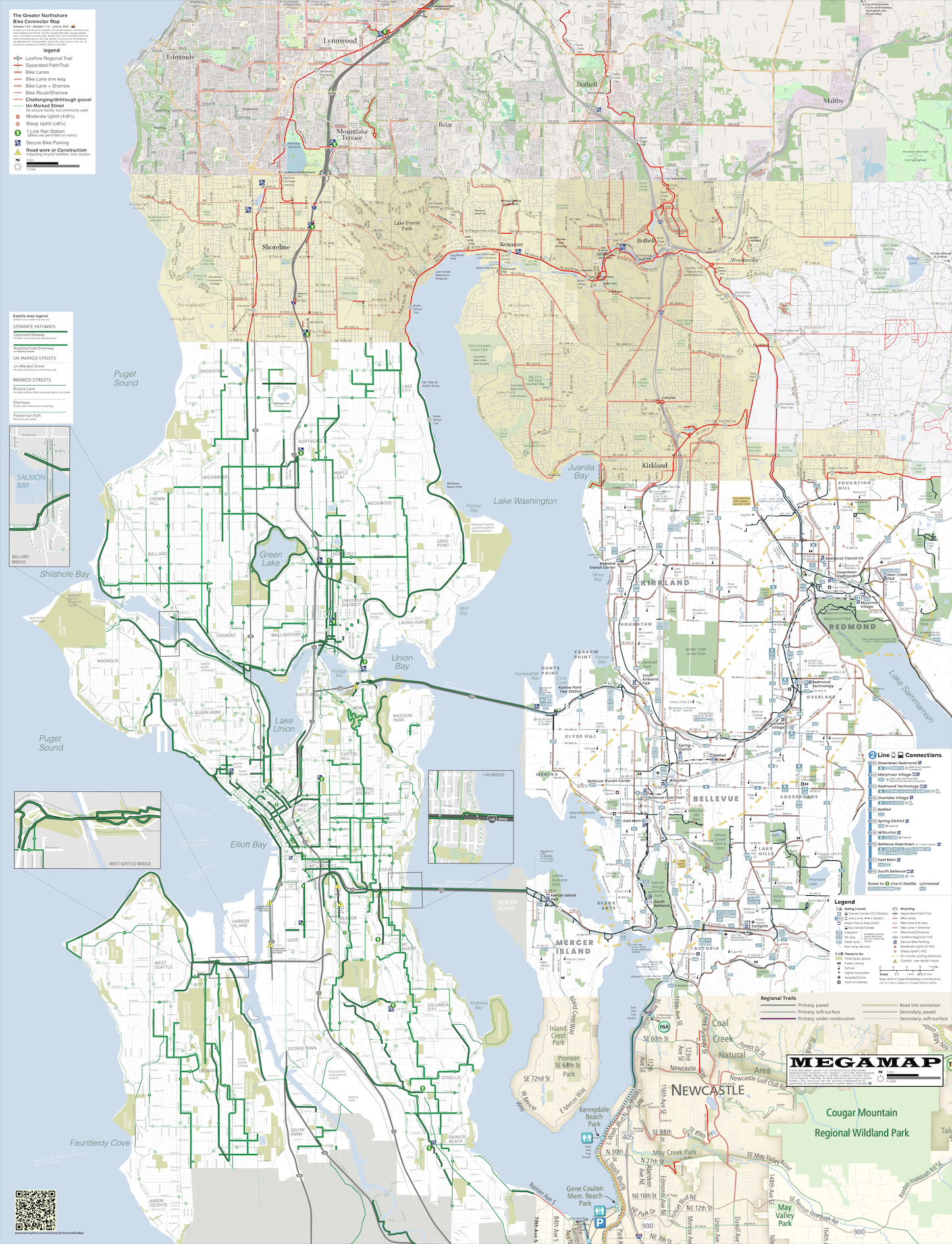
New Greater Northshore and MEGAMAP (Northwest King County) bike map update!
This version is very 1 Line light-rail focused, not just adding 1 Line stations but upgrading street labels for better wayfinding. It contains several other updates and two contributions as well.
https://solarbird.net/blog/2024/08/29/greater-northshore-bike-connector-map-1-4-release/
All previous advertised permalinks remain valid.
I love that Kamala's pick for vice-president is a data and maps nerd. This makes me very, very happy. 👇
Former geography teacher Tim Walz is really into maps • Minnesota Reformer
https://minnesotareformer.com/2024/08/06/former-geography-teacher-tim-walz-is-really-into-maps/
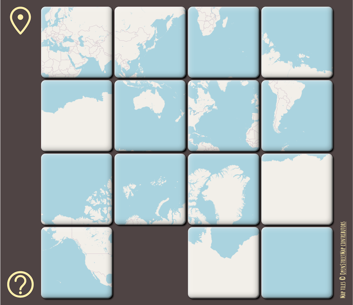
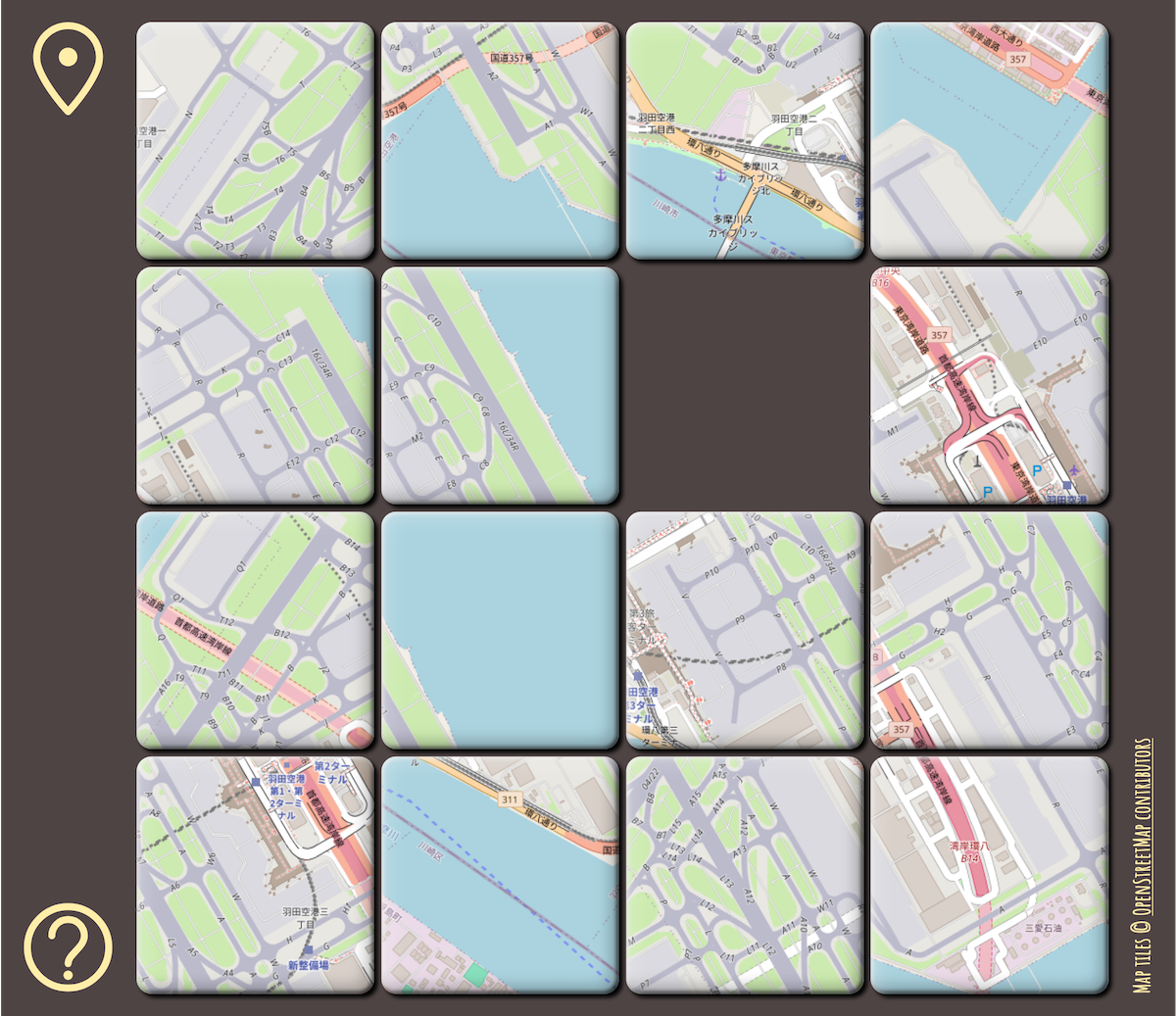
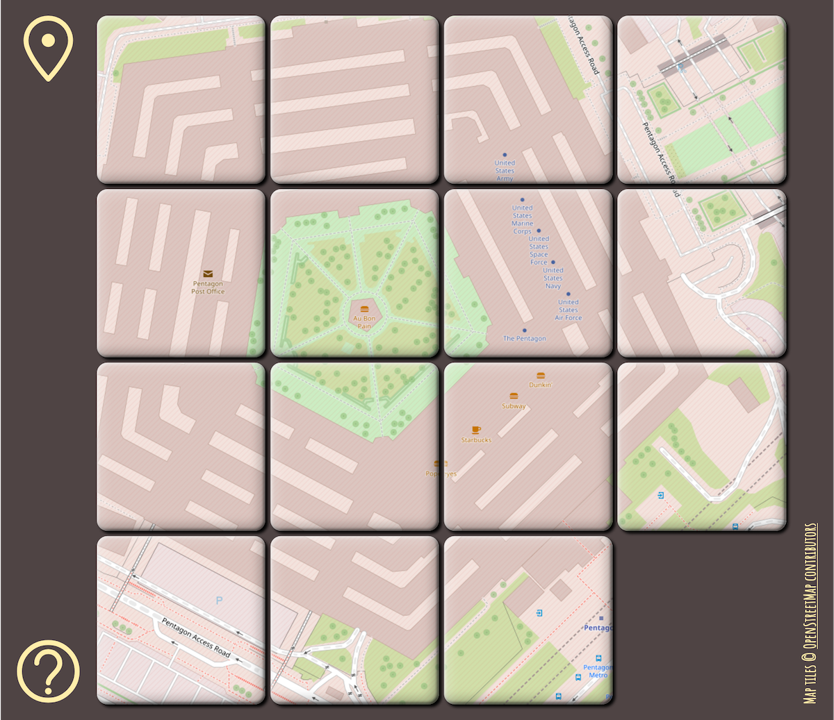
Finally finished implementing the classic 15 puzzle game but using the standard #OpenStreetMap tiles as the sliding pieces! 🗺️🧩
While there are many implementations of this game (some even let you upload your own image), as far as I know, not one directly uses OSM slippy map tiles for the pieces. I figured this would be a nifty side coding project and it was fun to do! 💪
Currently you can play any of 20 map locations. Enjoy! 🎉
RELEASE: Greater Northshore and MEGAMAP Bike Maps version 1.6 - 18 April 2025
Additions and changes this release:
* Large expansion north to Lynnwood City Centre across all of SW Snohomish County
* Extension of Interurban Trail in Edmonds to 78th Place West.
* Improved street labelling, mostly in SW Snohomish County.
* Route indicators at map edges describing continuations to destinations such as UW and City of Snohomish
https://github.com/solarbirdy/NorthshoreBikeMap/
Previous permalinks continue to work.
If you like these maps, maybe hit my Patreon:
https://www.patreon.com/solarbird
Thanks!
#BikeMap #northshore #seattle #Shoreline #LakeForestPark #Kenmore #Juanita #Bothell #Kirkland #Woodinville #Redmond #SnohomishCounty #Newcastle #maps #map
Using GPS in the year 1565
There’s a wonderful web app (“Allmaps Here”) that shows your GPS location on old maps. I love it.
https://www.verbeeld.be/2024/11/17/using-gps-in-the-year-1565/
RELEASE: Greater Northshore and MEGAMAP versions 1.4.6.
Changes this release:
* Addition of a "Difficult" label on Power Line Trail
* Removal of a bike store icon in Roosevelt and 84th
* Addition of fully-separated bike lane on 11th Ave NE from 47th to Ravenna, and on 12th Ave NE from Ravenna to NE 69th
* Waterfront Trail: Yesler to Union now open
* Eastlake from Fairview to John now has separated bike lanes
https://github.com/solarbirdy/NorthshoreBikeMap/
Previous permalinks continue to work. If you like these maps, maybe hit my Patreon?
https://www.patreon.com/solarbird
Thanks!
#BikeMap #northshore #seattle #Shoreline #LakeForestPark #Kenmore #Juanita #Bothell #Kirkland #Woodinville #Redmond #SnohomishCounty #maps #map
Mapstodon.space is a Mastodon server for cartography & geospatial professionals and enthusiasts. Ask questions, share your maps, chat around, enjoy the emojis!
You can find out more at https://mapstodon.space/about or contact the admin @jeremy
#FeaturedServer #Maps #Cartography #Mapping #GIS #Geospatial #Cartographers #Geography #Mastodon #Fediverse #FreeFediverse
RELEASE: Greater Northshore and MEGAMAP Bike Maps version 1.5 - 21 February 2025
Additions and changes this release:
* ALL OF NEWCASTLE. Thanks to Kerry Sullivan for help with May Creek Park Drive construction data
* NORTHERN RENTON, including substantial upgrades to Lake Washington Loop markings
* Bike lanes around 100th Ave W. in Edmonds
* Upgrade to 15th Avenue S in the Seattle map – bike lanes now have physical separation.
https://github.com/solarbirdy/NorthshoreBikeMap/
Previous permalinks continue to work.
If you like these maps, maybe hit my Patreon:
https://www.patreon.com/solarbird
Thanks!
#BikeMap #northshore #seattle #Shoreline #LakeForestPark #Kenmore #Juanita #Bothell #Kirkland #Woodinville #Redmond #SnohomishCounty #Newcastle #maps #map
RELEASE: Greater Northshore and MEGAMAP Bike Maps version 1.5.1 - 8 March 2025
Additions and changes this release:
* WATERFRONT TRAIL now open in Downtown Seattle. This is a small section opening, but it is an important connection
* HONEY DEW CREEK TRAIL in Newcastle/Renton. Turns out it's a popular paved shortcut
* Better road name markings a few places
* Warnings on 15th Avenue S bike lanes which are now _closed_ now 'til spring
https://github.com/solarbirdy/NorthshoreBikeMap/
Previous permalinks continue to work.
If you like these maps, maybe hit my Patreon:
https://www.patreon.com/solarbird
Thanks!
#BikeMap #northshore #seattle #Shoreline #LakeForestPark #Kenmore #Juanita #Bothell #Kirkland #Woodinville #Redmond #SnohomishCounty #Newcastle #maps #map
Google used to claim its mission was to organize the world's information. There are more appropriate words for what this is.
#Google #Maps #GulfOfMexico
#Maps & #Cartography picks of the day:
➡️ @openstreetmap - OpenStreetMap, the map anyone can edit
➡️ @polgeonow - Maps on current events & politics
➡️ @mapologies - Blog mixing maps with geography & other topics
➡️ @CaGIS - US org promoting map/GIS research, education & use
➡️ @BKG - German government agency for Cartography & Geodesy (in German)
➡️ @mappery - Highlighting maps in real life incl signs, posters, artworks etc
➡️ @wfgWorkshop - Artist & cartographer, maps of fictional worlds
🧵 1/8
With this plugin you can enable South and Southeast Asian scripts for OpenStreetMaps rendered in Web GL
Scripts supported: Bengali, Devanagari, Gujarati, Gurmukhi, Kannada, Khmer, Malayalam, Myanmar, Oriya, Tamil, and Telugu
Here is some R code to make the world a bit less rough.
```
library(tidyverse)
library(rnaturalearth)
library(sf)
smoo = function(x,y,s)
predict(smooth.spline(y,spar=s),x)$y
d = ne_coastline(110) |>
st_coordinates() |>
as_tibble() |>
group_by(L1) |>
filter(n() > 4)
for (s in seq(0,1,.01)) {
p = d |> mutate(
i = 1:n(),
X = smoo(i,X,s),
Y = smoo(i,Y,s)) |>
ggplot() +
geom_path(aes(x=X,y=Y,group=L1)) +
theme_void()
show(p)
}
```
#rstats #spatial #maps #gis
RELEASE: Greater Northshore and MEGAMAP Bike Maps version 1.8 - 8 June 2025
Additions and changes this release:
* LOTS. Too many to list here. Mostly Seattle, but not only Seattle, as they've dropped the 2025-26 bike map, with which we have issues.
Check the blog post for changes and notes:
Maps download:
https://github.com/solarbirdy/NorthshoreBikeMap/
Previous permalinks continue to work.
If you like these maps, maybe hit my Patreon:
https://www.patreon.com/solarbird
Thanks!
#biking #BikeTooter #GreaterNorthshore #seattle #northshore #SnohomishCounty #Shoreline #Edmonds #MountlakeTerrace #LakeForestPark #Briar #Kenmore #Juanita #Kirkland #Bothell #Woodinville #Maltby #KingCounty #Redmond #BikeMap #maps #design
There's been talk on the Fedi about why online maps like OSM and Google use the Mercator projection, and I think it needs a bit of clarification. (Do NOT snitch tag.)
Online maps are _mostly_ used at small scales, of a district or a city. At these scales, the earth is approximately flat, so users expect a map that is _conformal_, one that preserves angles and shapes.
Online maps are continuously zoomable from continents down to your house. They usually aren't rendered on your browser straight from vectors, but are batch-rendered offline into square tile images. If you're on a slowish Internet connection, you can see them loading individually.
As you zoom an online map, tiles get replaced with higher-resolution ones, and as you scroll, tiles get filled in to fill the gaps. You could theoretically scroll and zoom forever, so the map needs to not have a magically special reference latitude or longitude. These constrains mean that the map needs to be _equatorial_, so that no point gets special treatment, and _cylindrical_, so that meridians are vertical and lines of latitude are horizontal.
And which is the map projection that is all of equatorial, cylindrical and conformal? Mercator!
Do you want to host State of the Map 2026, the global OpenStreetMap conference?
We're now soliciting bids and we'd welcome your suggestions!
Read more: https://wiki.openstreetmap.org/wiki/State_of_the_Map_2026/Call_for_venues
(@sotm 2025 is happening in Manila)
#OpenStreetMap #OSM #geo #maps #sotm #sotm2026
An Anciente Mappe of Fairyland by Bernard Sleigh, 1920
If you believe in fairies, this ancient map and guide will help you know them and find them
By Paul Sorene
Fairyland at PG:
https://www.gutenberg.org/ebooks/subject/37291
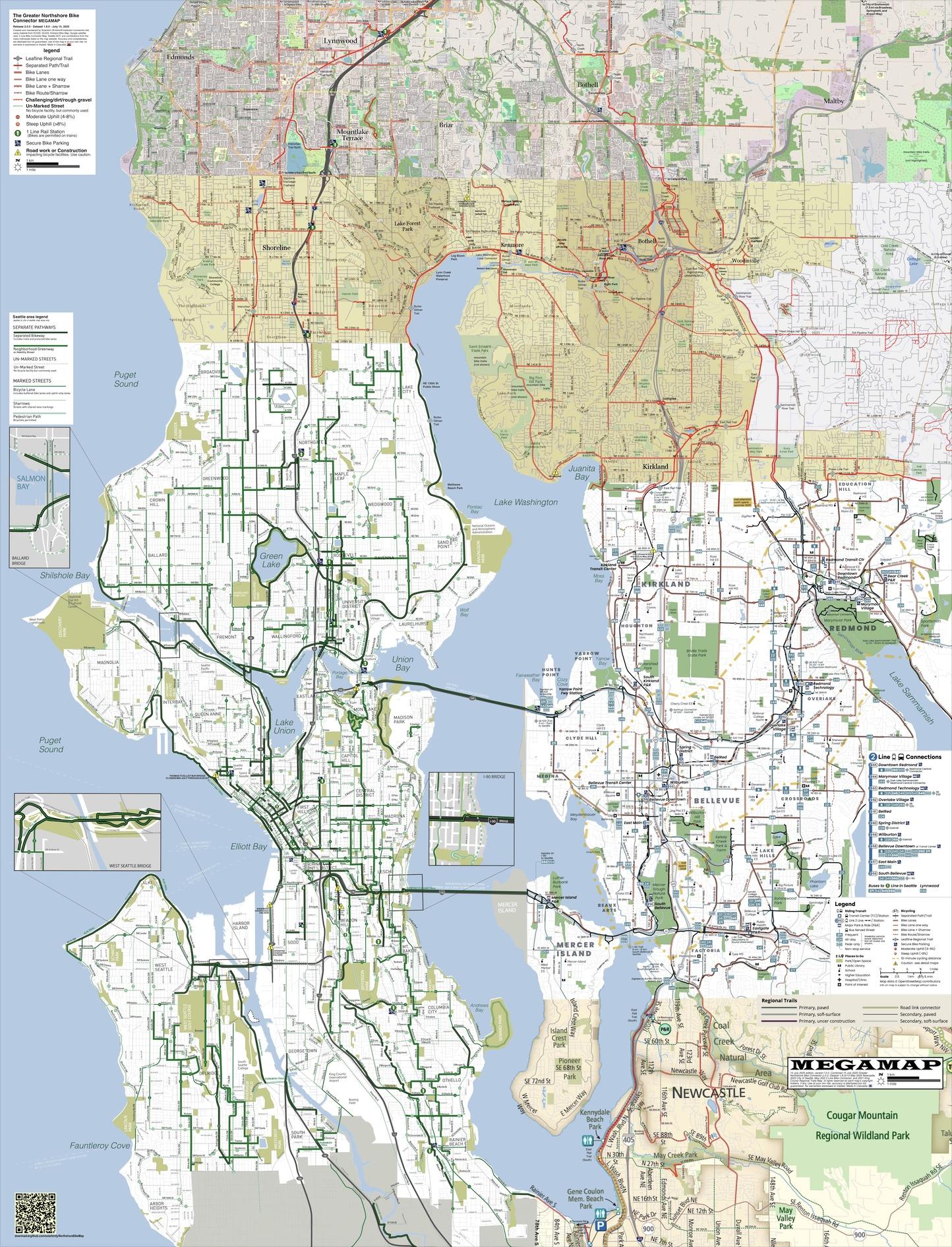
RELEASE: Greater Northshore and MEGAMAP Bike Maps version 2.0 - July 15, 2025
Additions and changes this release include a pretty big project of enlarging City of Seattle's street name labels, which were too damn small.
But there's more; check the blog post for changes and notes:
https://solarbird.net/blog/2025/07/14/maps-release-greater-northshore-bike-connector-megamap-2-0/
Maps download:
https://github.com/solarbirdy/NorthshoreBikeMap/
Previous permalinks continue to work.
If you like these maps, maybe hit my Patreon:
https://www.patreon.com/solarbird
Thanks!
#biking #BikeTooter #GreaterNorthshore #seattle #northshore #SnohomishCounty #Shoreline #Edmonds #MountlakeTerrace #LakeForestPark #Briar #Kenmore #Juanita #Kirkland #Bothell #Woodinville #Maltby #KingCounty #Redmond #BikeMap #maps #design
Last week we published a set of three in-depth #map reports covering territorial control across #Somalia's claimed territories from 2023 to present. The June 2024 report is free for all readers, and shows the height of "#IslamicState" (#ISIS/#ISIL) control in the country:
https://www.polgeonow.com/2025/06/somalia-territorial-control-map-2024-isis-shabaab.html
#HornOfAfrica #cartography #maps #geography #Somaliland #Puntland #SSC_Khaatumo #mapping @geography @cartography @geopolitics #AlShabaab #AlQaeda #security #OSINT
En.osm.town is an independent Mastodon server for people active in the OpenStreetMap community.
This server has been operating since 2018.
You can find out more at https://en.osm.town/about or contact the admin @compass
cc @openstreetmap
#FeaturedServer #OpenStreetMap #OSM #Geospatial #GIS #Maps #Mapping #Cartography #Mastodon #Fediverse #FreeFediverse